
3D Laser Scanning Services
for AECO Applications
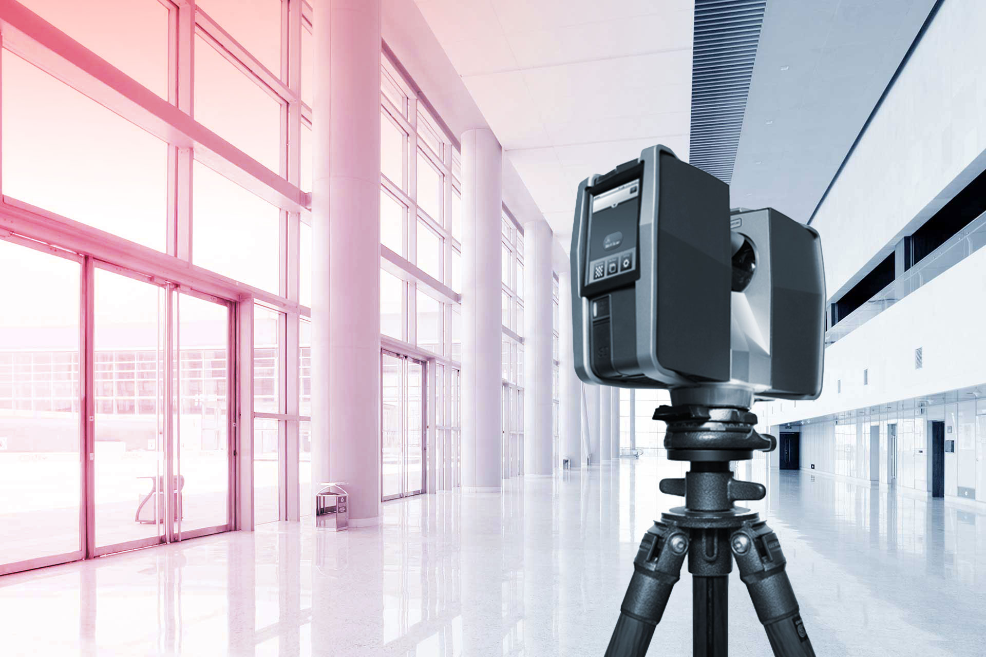
High accuracy mobile and/or stationary laser scans of your facility output to industry standard point cloud formats. Take control of the scan data yourself, or supercharge your output with our Scan-to-BIM/CAD deliverables, custom-made to your specifications. We specialize in LIDAR scanning and Scan-to-BIM for Architecture, Engineering, Construction, and Operations (AECO). Ensure your project is built on a sturdy foundation of site-verified measured data.

Scan Only
If you already know your way around point clouds, or you want to start leveraging these powerful datasets for yourself, our scan-only service is for you. We capture the property and supply high definition point clouds in RCS/RCP, E57, or LAS. Enjoy the confidence of working with high precision scan data inside your CAD/BIM workspace.
Scan + BIM/CAD
We prepare high accuracy as-built models and drawings of building structure, architecture, MEP, and equipment so you can focus on project design and execution. We carefully reference the laser scanned point cloud to develop precise BIM and CAD deliverables for Revit, AutoCAD, and other popular AEC applications.
Our Technology Partners...


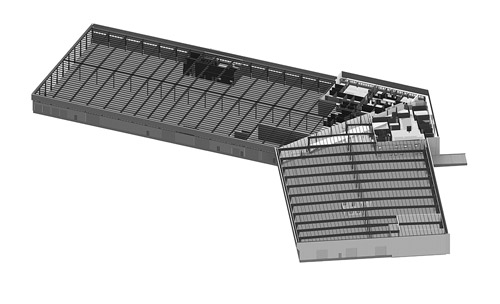
Point Clouds / Scan Data
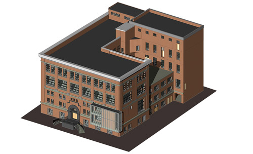
As-Built Revit & CAD Samples
-
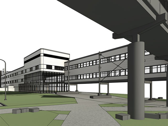
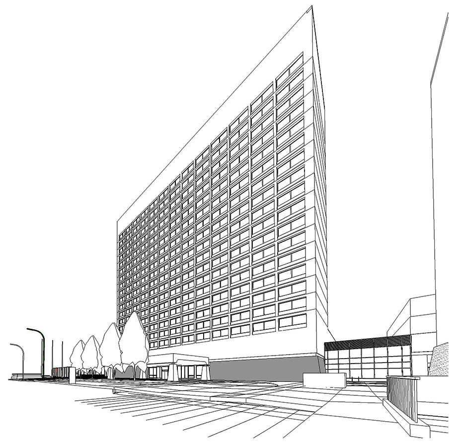 Commercial Real Estate
-
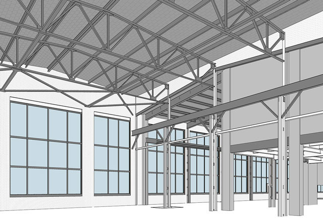 Industrial Spaces
-
 Power Stations
-
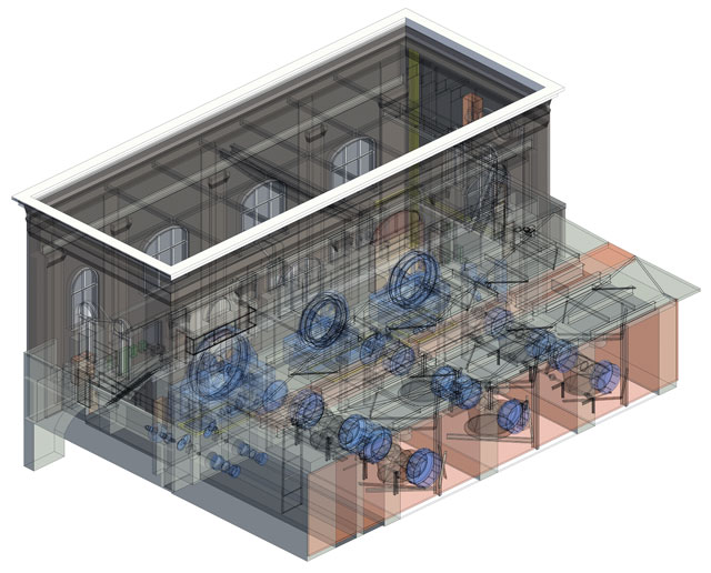
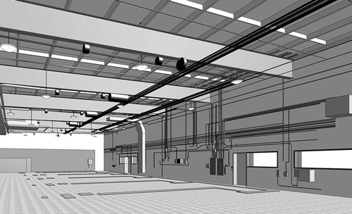 MEP for Clash Detection
-
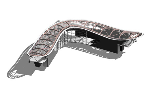 Complex Building Geometry
-
 University & College Campuses
-
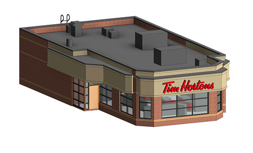 Retail Buildings
-
 Institutional Facilities
-
 Datacenters
-
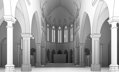 Heritage & Preservation
-
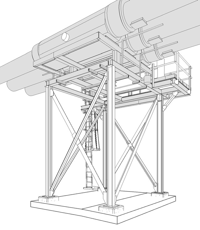 Processing Plants
-
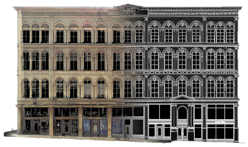
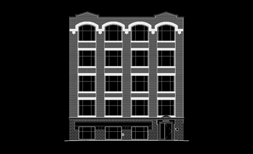 Building Elevations
- Key Benefits of High Definition Laser Scanning
- Dimensional verification of existing conditions result in fewer design errors and change orders
- Possession of "Digital Twin" results in fewer site visits required by technicians and personnel
- Clash detection and deviation analysis of design/construction model vs. actual site
conditions
- Point-in-time digital archive of facility for future reference and interrogation
- High-detail, high-precision imaging for fabricators and installers
- Import directly into Revit, Autocad, Civil3D, Navisworks, Archicad, Microstation, Rhino, Solidworks and more
- Free, standalone point cloud viewers including Autodesk Recap, Scene Light, Cloud Compare etc.
Frequently Asked Questions
What is 3D laser scanning and scan-to-BIM?
3D laser scanning uses LiDAR technology to capture a building's exact existing conditions as a high-definition point cloud — millions of precise measurements taken on site. Scan-to-BIM then converts that point cloud into accurate as-built models and drawings of the building's structure, architecture, MEP, and equipment, using professional BIM software like Revit and Archicad.
What deliverables and file formats do you provide?
We offer two tiers. Scan Only delivers high-definition point clouds in RCS/RCP, E57, or LAS, viewable in Autodesk ReCap, Scene, or CloudCompare. Scan + BIM/CAD delivers high-accuracy as-built models and drawings of your building's structure, architecture, MEP, and equipment — built in Revit and AutoCAD, with support for Civil3D, Navisworks, Archicad, MicroStation, Rhino, and SolidWorks so the files drop into your existing workflow.
What level of detail (LOD) do you model to?
We model to the Level of Development your project requires — from LOD 200 for early planning through LOD 350 for detailed coordination and fabrication. Tell us how the model will be used and we'll match the LOD to it.
How accurate is your laser scanning?
Our high-definition stationary scanners (FARO) are survey-grade, capturing local building geometry to within 3 mm of true existing conditions — reliable enough for dimensional verification, clash detection, fabrication, and installation. For broader coverage, our mobile SLAM scanners (NavVis) deliver roughly 20 mm accuracy with superior speed and reach, ideal for planning, design, scan-to-BIM, and scan-to-CAD. We match the right platform to your project's accuracy needs.
What types of buildings and sites do you scan?
We scan office towers, industrial spaces, processing plants, power stations, mechanical rooms, staircases, data centers, construction sites, university and college campuses, retail, institutional facilities, residential and multi-residential buildings, exterior cladding, and heritage or preservation sites. If it's architectural or structural, we can scan it, from the factory floor to the most complex architectural detailing.
How long does 3D laser scanning and scan-to-BIM take?
On-site capture speed depends on the method. With terrestrial (stationary) scanning, each fixed-location scan takes about 3 to 5 minutes in intensity (black-and-white) mode, and our technicians capture and register 70 to 100 scans per day; color scanning takes longer. Mobile SLAM scanning covers large areas far faster, completing sizable sites in a single day depending on complexity and access. Scan-only point clouds are delivered shortly after the site visit, while scan-to-BIM modeling time depends on the level of development and building complexity. After approval, our coordinator arranges site access promptly and mobilizes our technicians; final deliverables are posted to Planmine for immediate retrieval.
What does 3D laser scanning cost?
Scanning and scan-to-BIM are priced per project. Cost depends on location, the size and complexity of the area to be scanned, which deliverables you need (scan-only point clouds versus Scan-to-BIM/CAD models and drawings), and the Level of Development (LOD) required for modeling. Request a quote for an estimate on your project.
What is your service area, and do you charge for travel?
Extreme Measures deploys to any location across the United States and Canada. Travel is typically factored into our project price, so your quote reflects the full cost of getting our scanning technicians on site wherever your property is located.
How do I get started?
Order online or contact us at 1.877.963.2787 or mail@xmeasures.com to discuss your project, scope, and timeline.